Weymouth BRIC

Weymouth BRIC

Weymouth BRIC

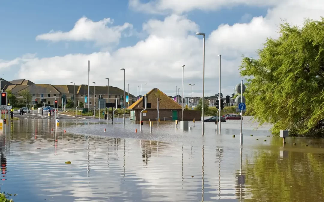
The Building Resilience in Flood Disadvantaged Communities (BRIC) project was developed to support people and communities in Weymouth likely to be affected by flooding, particularly vulnerable groups.

Flood Risk in Weymouth Guide

The Flood Risk in Weymouth guide is all about flooding in the Melcombe Regis and Weymouth Harbour area. It has been produced so that you can find out about flooding in the Melcombe Regis and the Harbour area, how flooding may affect you, who’s who and who’s doing what and how you can do your bit and be more prepared.

It’s for property owners, businesses and for those who rent a property in this area. The guide has been produced by the Dorset Coast Forum with support from Dorset Council, BCP Council, Weymouth Town Council, the Environment Agency, Wessex Water, and residents of Weymouth.

Weymouth BRIC Background

Dorset Coast Forum were awarded £141,000 (69% of the project budget) from the European Regional Development Fund via the Interreg France (Channel) England programme, whilst match funding is being provided through expertise offered by Dorset Council.

The BRIC Weymouth project came to an end in March 2023 and delivered:

  • Engagement with communities in Flood Risk Management and increase flooding resilience.
  • Developed a joint approach, linking local communities, expertise and policy makers.
  • Raised awareness by working with community networks to develop Flood Champions trained in safety measures and incident reporting.
  • Created the Flood Risk in Weymouth Guide as detailed above.

West Dorset Walkers Welcome

West Dorset Walkers Welcome

West Dorset Walkers Welcome

FREE information leaflet and map!

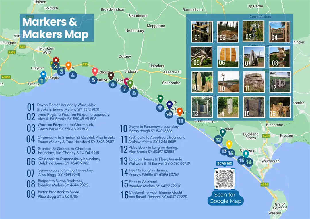
Find out how and where to find the parish boundary markers as you walk the West Dorset Coast Path, discovering the unique hand made markers as you walk from parish to parish. You can also scan the QR code on the map whilst walking to load a Google Map of the marker locations.

West Dorset Walkers Welcome

The Dorset Coast path is enjoyed by local people and visitors as a key way to experience and enjoy the stunning coastal landscape, sea views and numerous coastal communities through which it passes. The underlying geology and hydrology of the coastline result in a stunning topography which is subject to dynamic and sometimes rapid change, resulting in some difficult locations to navigate for the everyday walker. Many of these locations are found close to parish communities where the coast path is most popular. This project seeks to improve those locations.

West Dorset Walkers Welcome project was a two-phase, West Dorset Coast Path improvements and the artistic parish boundaries marker project.

West Dorset Coast Path improvements

Physical path improvement works at 12 locations along the Dorset Coast Path were carried out in 2019. Path works improved and facilitated year-round access for local people and visitors, for walkers to safely use and enjoy the path whilst also linking into local paths networks/parishes and parish attractions along the coast path.

Information Maps

If you are a local business, tourist attraction, holiday accommodation or information centre, please contact us for a supply of the information maps to share dorset.coast@dorsetcouncil.gov.uk

Parish Boundary Markers

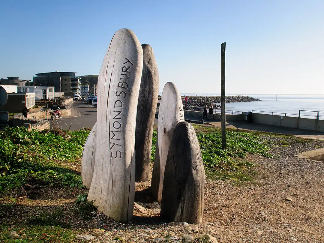
Parish boundaries markers provide welcome entry and exit points along the coast path highlighting for the traveller passage through coastal communities.

Local artists were commissioned in 2019 for the first stage and in 2021 for the second stage to develop contemporary parish boundary artwork pieces to reveal to the walker where and when they pass from one parish to another when walking along the West Dorset Coast path. These pieces are collaboration projects between the artist, landowners and craftspeople to produce artwork pieces that represents the heritage of that particular parish boundary using a range of materials such as, stone, wood, metal.

This project has produced 16 unique, beautiful parish boundary markers demonstrating high quality expertise in both arts and crafts.

Parish Boundary Artwork

1. Devon into Dorset boundary at Ware

Grid Reference: SY 3312 9170

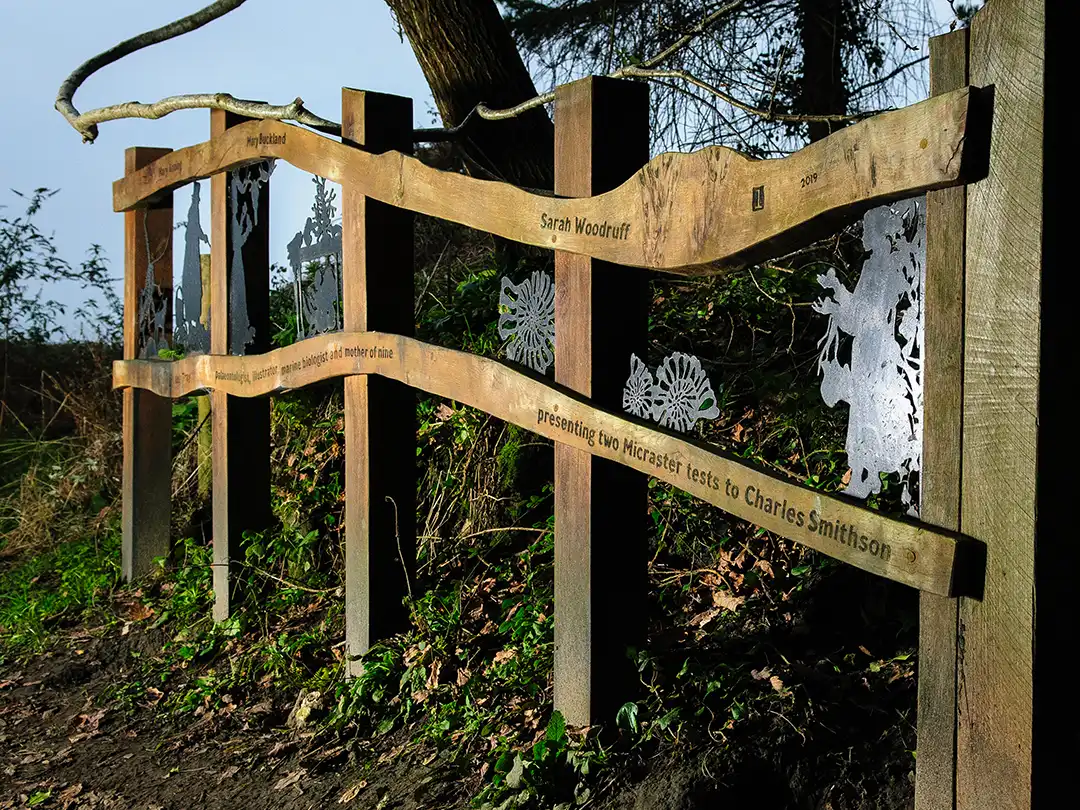
To celebrate the iconic 19thC women of Lyme Regis pivotal in Lyme Regis reputation as the cradle of modern palaeontology – Mary Anning, Mary Buckland, & Sarah Woodruff.

Artists:

Photo: © Pete Millson 2022

2. Lyme Regis to Wootton Fitzpaine boundary

Grid Reference SY 35048 93 808

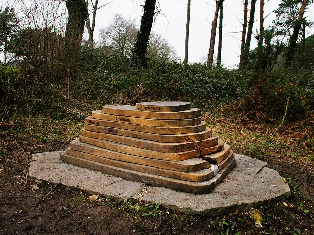
Highlighting the beautiful undulating local landscape with its distinctive hilltops providing birds eye viewpoints, for example, Lamberts Castle, Colney Castle, Stonebarrow, and Trinity, Thistle and Timber Hills.

Artists:

Photo: © Pete Millson 2022

3. Wootton Fitzpaine to Charmouth boundary

Grid Reference SY 35048 93 808

Remembering Mary Anning and her work searching for fossils in the Charmouth mudstone cliffs and discovering the first correctly identified ichthyosaur.

Artist:

Photo: © Pete Millson 2022

4. Charmouth to Stanton St Gabriel boundary

Grid Reference SY 3698 9307

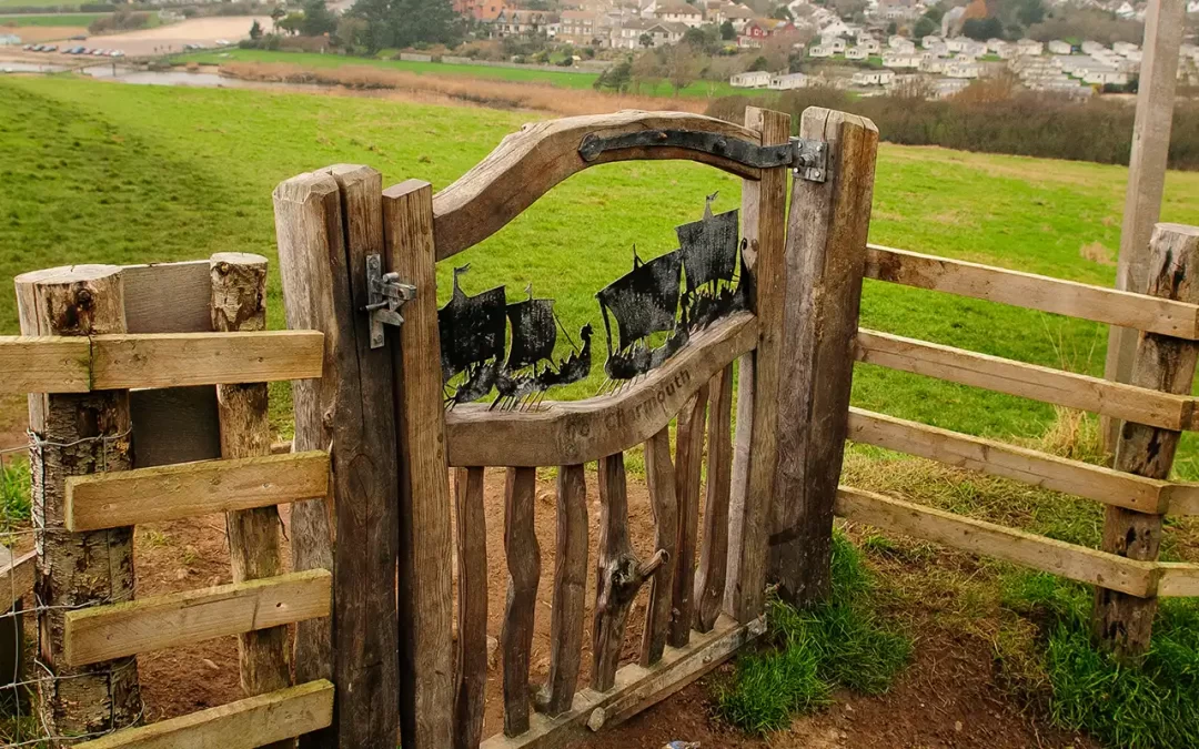
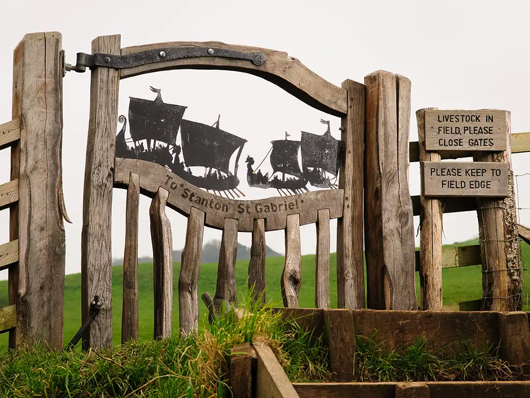
To commemorate the alleged 836 Danish Viking landings on Charmouth beach. As you approach the gate the Viking landskip warships align with the sea horizon to take you back in time and witness the Viking fleet advancing towards the shore.

Artists:

Tara Hansford

Photo: © Pete Millson 2022

5. Stanton St Gabriel to Chideock boundary

Grid Reference SY 4104 9215

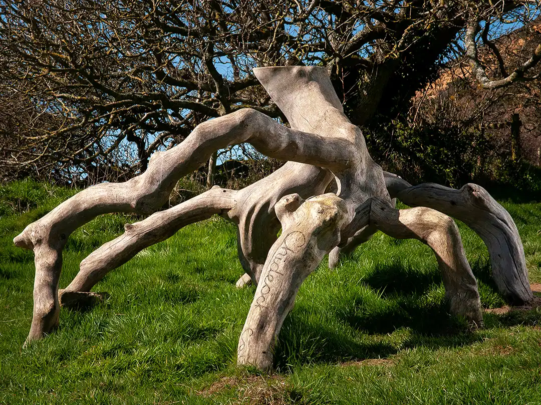
Enhances the links between the two parish communities providing a seat sculpted from local fallen trees echoing the weathered trees and hedgerows in this location. Inviting local people and coast path walkers to stop, sit and contemplate and connect with their surroundings.

Artist:

Photo: © Pete Millson 2022

6. Chideock to Symondsbury boundary

Grid Reference SY 4348 9146

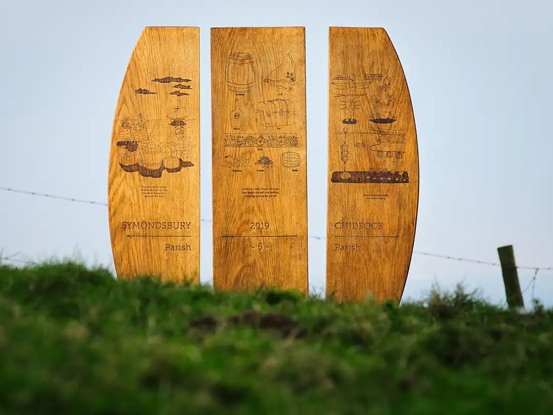
From the distance the walker can see the form suggesting the shape of a barrel which when reached invites the walker to stop and consider the coasts rich smuggling history.

Artist:

Photo: © Tara Hansford 2020

7. Symondsbury to Bridport boundary

Grid Reference SY 4591 9048

Remembering the “Wildcats of Bridport” a group of women netmakers who downed tools, went on strike and marched in protest of a pay cut and secured the support of Bridport.

Artist:

Photo: © Pete Millson 2022

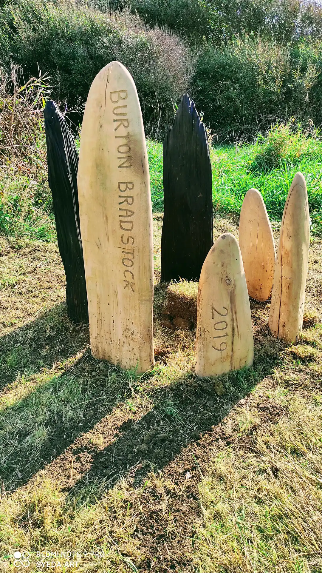
8. Burton Bradstock to Swyre boundary

Grid Reference SY 5106 8786

Echoing how this landscape changes from winter into summer with smooth, bleached to dark jagged elements. An Oak tree protected by them will grow and distort because of this exposed landscape but provide a permanent boundary marker for future generations.

Artist:

Photo: © Pete Millson 2022

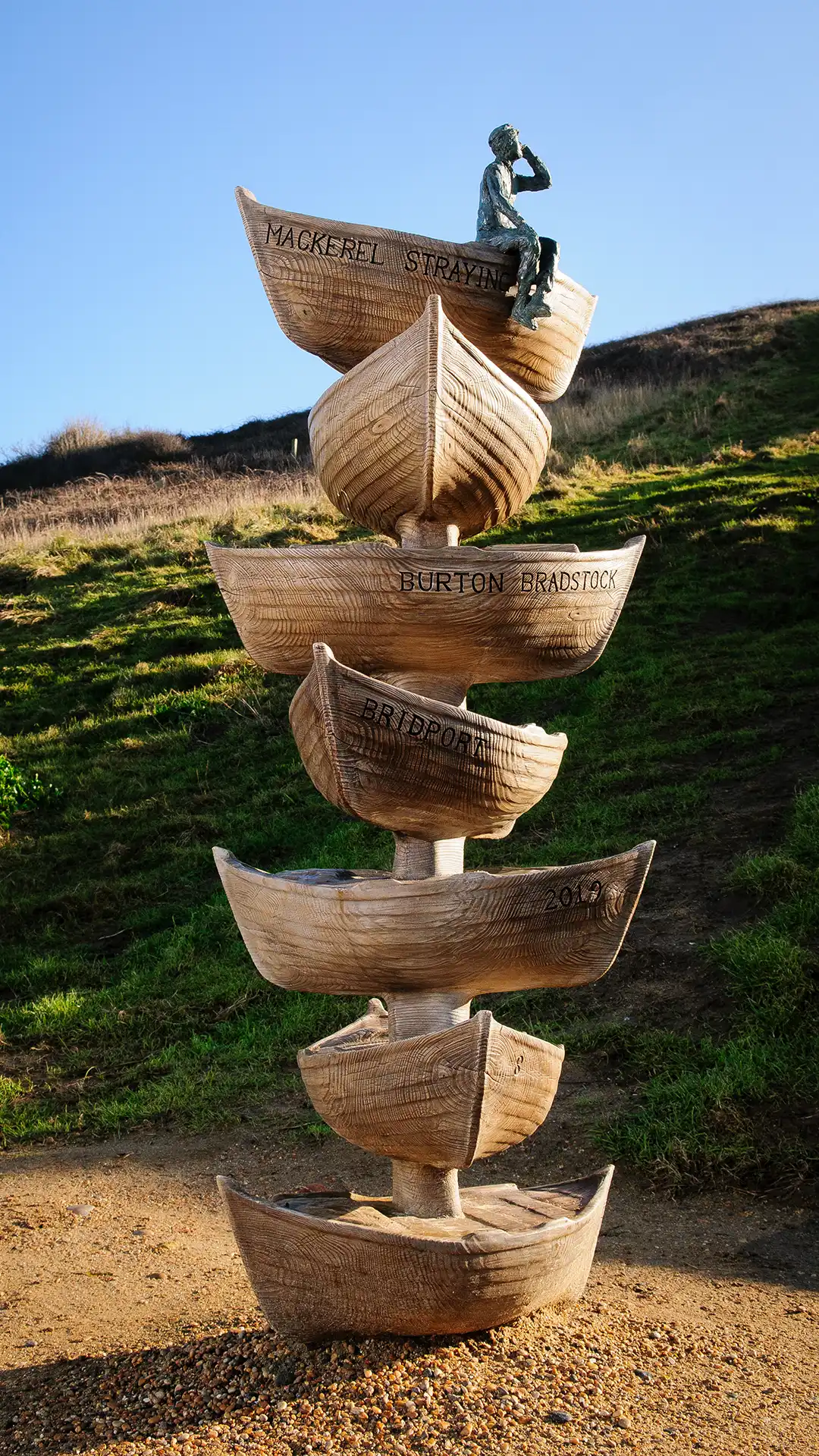
9. Burton Bradstock to Swyre boundary

Grid Reference SY 5106 8786

Echoing how this landscape changes from winter into summer with smooth, bleached to dark jagged elements. An Oak tree protected by them will grow and distort because of this exposed landscape but provide a permanent boundary marker for future generations.

Artist:

Photo: © Tara Hansford 2020

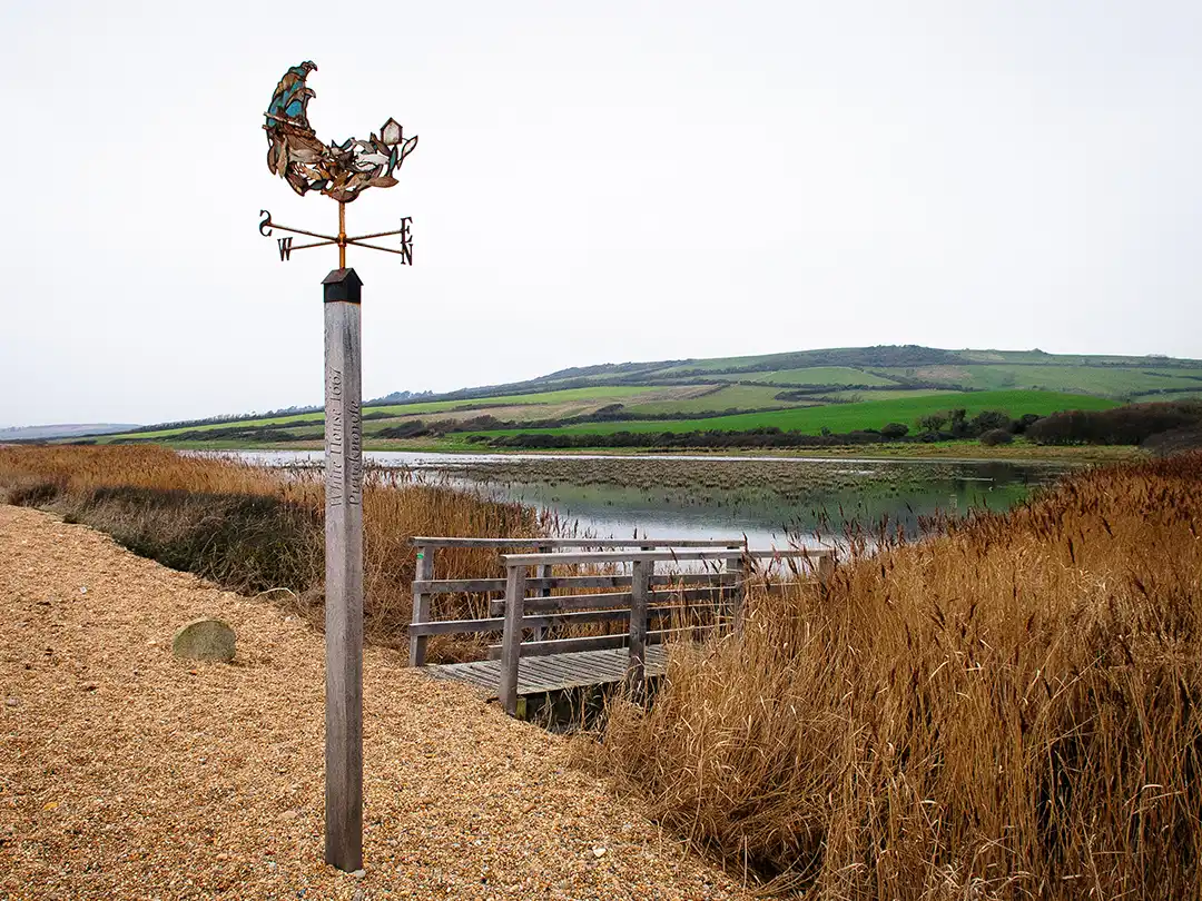
10. Swyre to Puncknowle boundary

Grid Reference SY 5401 8586

In 1667 a white house stood on Chesil beach providing refuge for shipwrecked sailors washed up along the beach. Long since lost but remembered by a boundary marker that will help walkers brace themselves in windy weather! 

Artists:

Will Pinder Metal worker/forger

Jake Reilly Carpenter

Photo: © Pete Millson 2022

11. Pucknowle to Abbotsbury boundary

Grid Reference SY 5245 8689

Spiral tassleweed, common mouse ear, toothed medick …. this boundary marker celebrates the fascinating names of the remarkable plants supported by The Fleet and Chesil Beach.

Artist:

Photo: © Pete Millson 2022

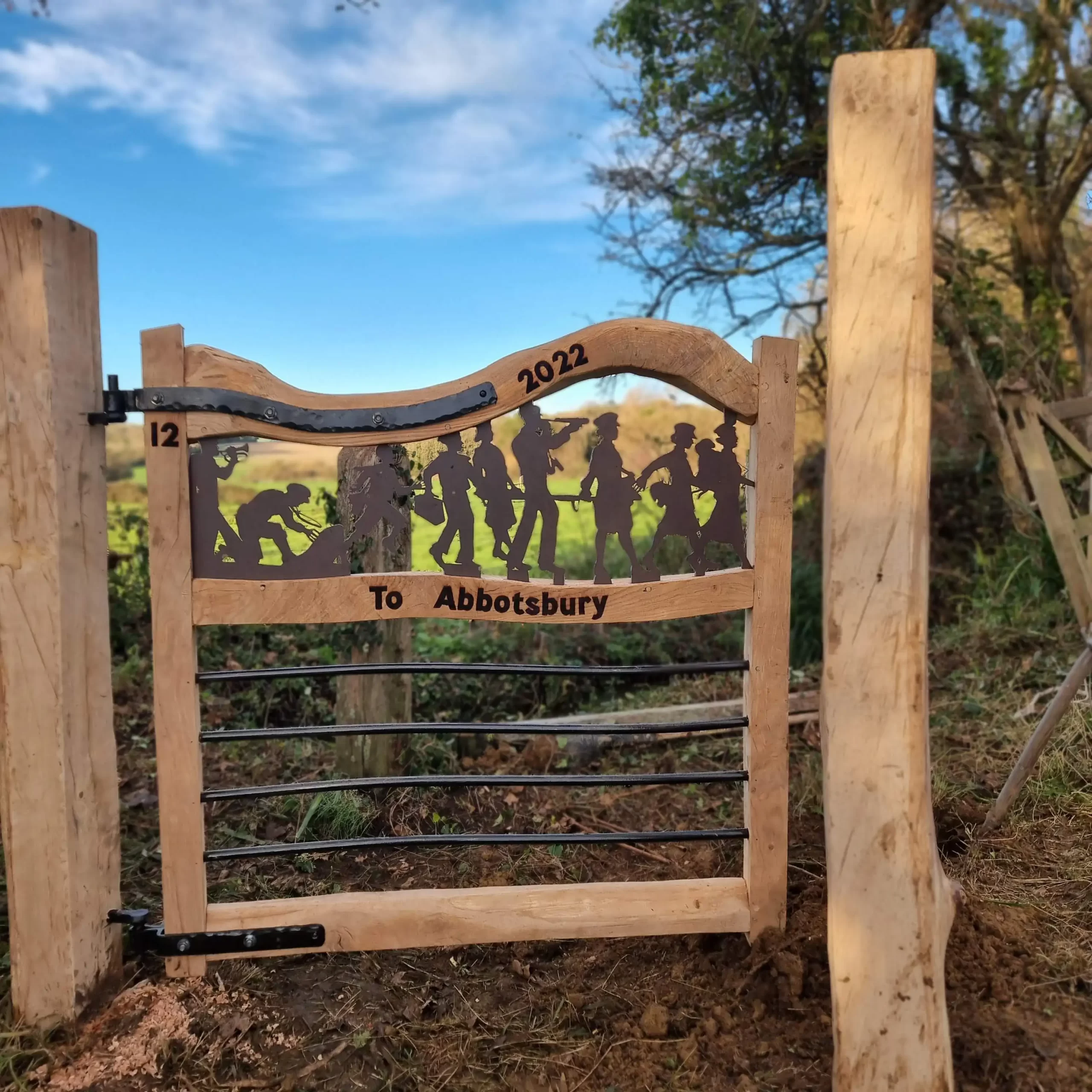
12. Abbotsbury to Langton Herring

Grid Reference SY 60597 82583

Three hand-made gates, kissing fence and fencing over bridge. Incorporating artistic metalwork depicting historic imagery relating to the parishes


Artists:

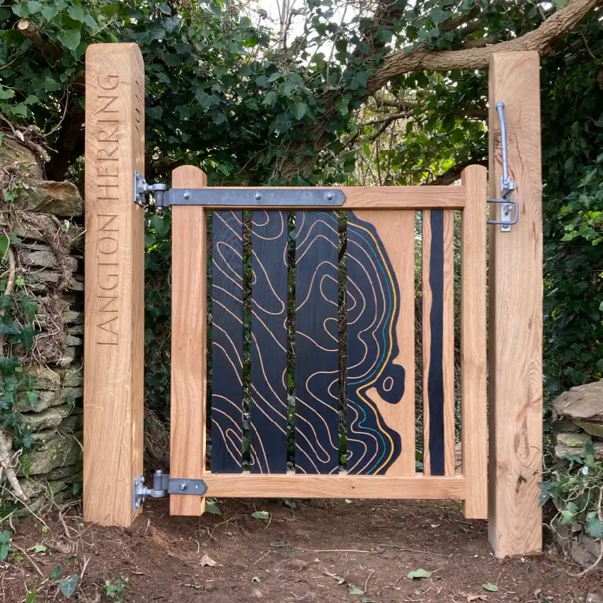
13. Langton Herring to Fleet

Grid Reference SY 61596 80739

Hand-made gate depicting a map of the area showing the contour lines, the coast path (yellow line) and the predicted sea level rise (blue line).

Artists:

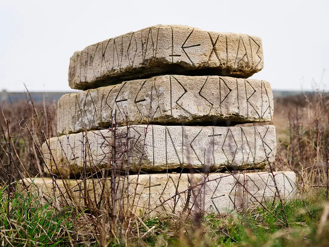
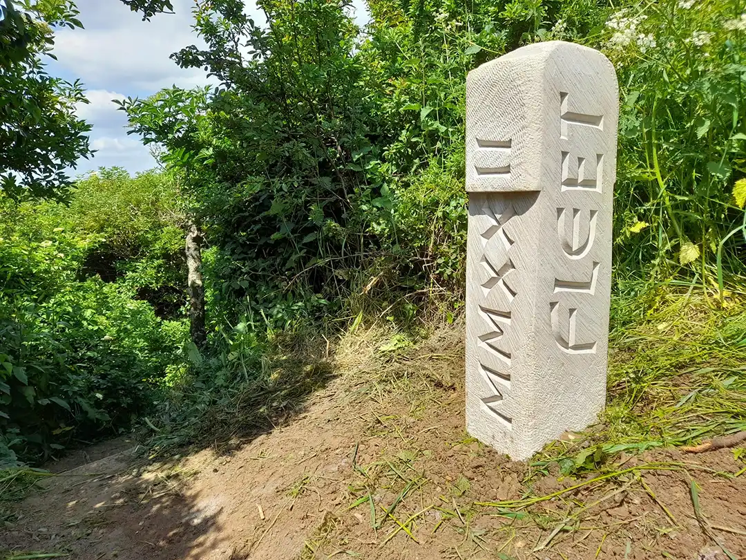
14. Fleet to Langton Herring

Grid Reference SY 61596 80739

Stone boundary marker with letter carvings.

Artist:

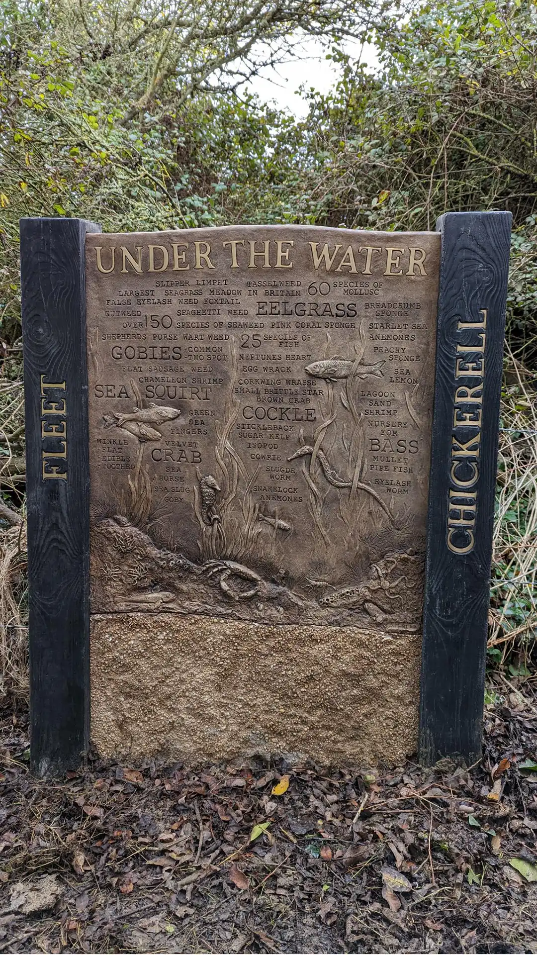
15. Fleet to Chickerell

Grid Reference SY 64137 79220

‘Under the water’ sculptured marine life information marker.

Fleet to Langton Herring

Grid Reference SY 61596 80739

Stone boundary marker with letter carvings.

Artist:

16. Chickerell to Fleet

Grid Reference SY 64137 79220

Hand carved English oak gates with screens inspired by the unique landscape of the Fleet Lagoon and the reed beds at this location.

Artists:

Contact

Dorset Coast Forum

Dorset Coast Forum

For further information about this project please contact:
dorset.coast@dorsetcouncil.gov.uk
01305 224833

West Dorset Walkers Welcome Project

This project was led by Dorset Council and coordinated by Dorset Coast Forum as part of the Dorset Coastal Connections portfolio. Funding was from the Coastal Communities Fund, managed by the Ministry of Housing, Communities and Local Government (MHCLG).

Swanage Seafront Masterplan

Swanage Seafront Masterplan

Swanage Seafront Masterplan

Swanage Town Council working in partnership with Dorset Coast Forum have created the Swanage Seafront Masterplan.

Project overview

The masterplan is a long-term working strategy providing a vision to inform the future management of the seafront. The seafront masterplan covers an area from Swanage Pier to the stream at Ocean Bay and it includes greenspaces, seafront areas and beach.

In July 2023, Swanage Town Council unanimously adopted the masterplan with only minor amendments informed by Phase 2 public engagement.

On behalf of everyone at Dorset Coast Forum and Swanage Town Council thank you to everyone who helped us shape and inform the masterplan and we are really excited for the future projects that are introduced as part of this aspirational vision for Swanage’s seafront.

Find out more about Swanage Seafront Masterplan