

Chesil Cove Curved Seawall
Chesil Cove Curved Seawall

Dorset Council, working in collaboration with partners, are developing a proposal for the repair and update of Chesil Cove Curved Seawall.
Project updates

Project overview
Chesil Cove is a curved bank forming the end of Chesil Beach. The Chesil Cove curved seawall was built in 1965 as a means to protect the toe of the steep bank known as West Weares. It was designed to deflect waves and prevent major slumping of the land above which previously had experienced ground slippage. Under the direction of the Shoreline Management Plan(External link), Chesil Cove comes under the “hold the line” approach meaning defences should be maintained or replaced where they already exist.
The beach at Chesil Cove is popular with families who favour the shallow waters, divers who explore the many shipwrecks in the area and also with walkers who make use of the promenade above the wall. There are also many beach huts up above, dotted on the slope.
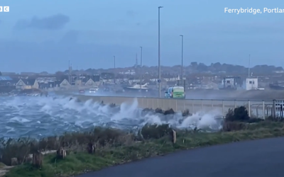
There is consistent heavy wave attack along this area of coast but the wall also sustains damage from the following:
- Coastal erosion
- Beach loss
- Foreshore lowering
- Structure undermining
Some repairs were undertaken on the wall in 2011 but these have now been undermined and the sea is causing rotational movement at the southern end, threatening it further.
If no action was taken at the site and the ground started to slump again, the main A354 road would be at risk as well as coastal paths, homes, chalets and utilities. Various studies have taken place to identify that urgent action is needed.
Visit the Dorset Coast Have Your Say page for more information and to have your say on this project:
>> Chesil Cove Curved Seawall Have Your Say page
Who’s listening?
Chesil Cove Curved Seawall


")